How to Plan a Trip Along the Superior Hiking Trail
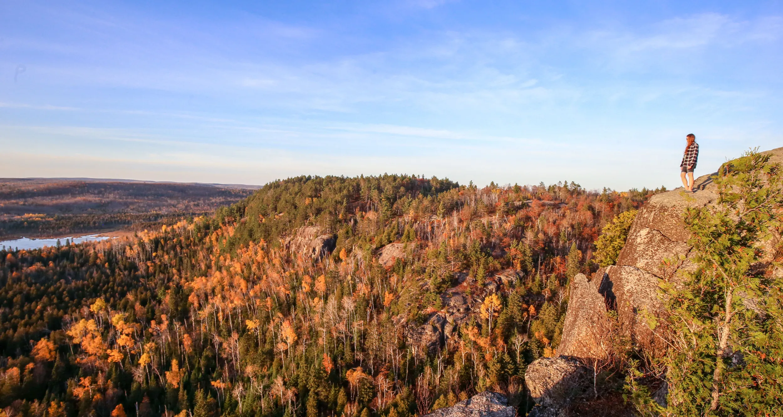
The Superior Hiking Trail (SHT) links the Minnesota-Wisconsin border in Jay Cooke State Park to far northern Minnesota — nearly to Canada. It’s maintained by volunteers from the Superior Hiking Trail Association and features beautiful, sweeping vistas of Lake Superior and the Sawtooth Mountains.
Here is how to plan a trip along the iconic trail, including tips on parking, camping and the most popular sections…
How can you experience the Superior Hiking Trail?
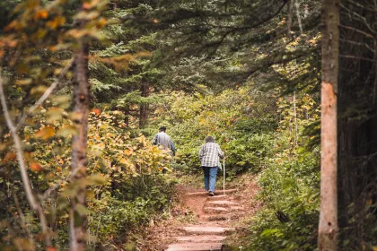
Some trail users choose to go on shorter day hikes and others head out for arduous backpacking adventures.
For many backpackers, the trail begins north of Duluth — at the Martin Road Trailhead. Whether you choose to start there or not, its northern terminus is at 270 Degree Overlook, just south of Canada and on the eastern end of the Border Route Trail.
It’s 300 miles if you start at the WI-MN border, or 260 if you start at Martin Road Trailhead north of Duluth.
What’s the terrain like?
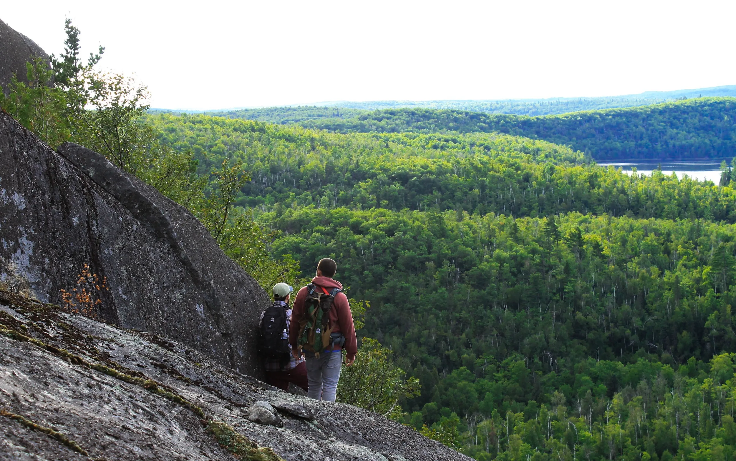
Terrain varies along the trail. Some sections are quite rugged, and some are relatively flat — like near the Two Harbors area. In the rugged sections, you’ll see steep ups and downs, so hiking speeds vary significantly.
If you’re hiking the SHT, a good rule of thumb is to plan for a max speed of 2 miles per hour and a minimum of 1 mile per hour. About 8-10 miles per day is most people’s maximum unless they’re frequent hikers.
Where can you park?
Each official trailhead has a parking area. If you’re backpacking overnight, you’ll be able to park in any SHT trailhead north of Duluth.
You cannot park overnight at any State Waysides. If you’re parking in a Minnesota State Park, you’ll need a vehicle permit.
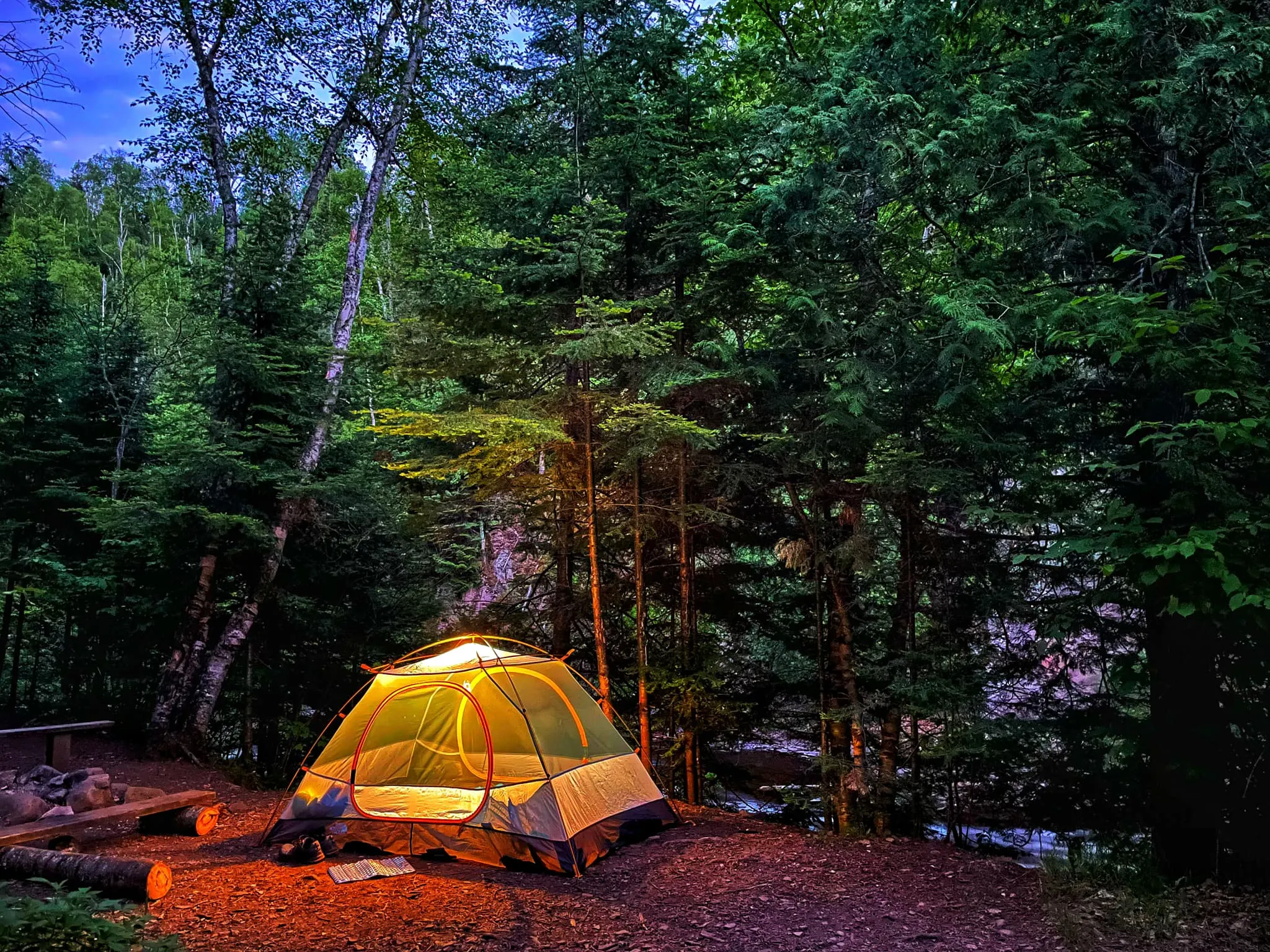
Do you have to camp?
You can either through-hike the entire Superior Hiking Trail and camp along the way, or break up your trip and stay in a state park, hotel or RV. Many people choose to do one-to-three-night sections if they’re camping; others opt for day hikes.
What is camping along the Superior Hiking Trail like?
Rustic; all sites are shared, and there are no reservations. This can lead to fun conversations around a campfire if you’re at a popular site. Many have an “overflow” area as well.
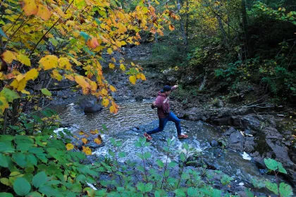
Your camping experience will vary due to water sources and views. Some are extremely popular, and some will leave you alone for the night. Some are near a lake (Lake Agnes) and some are along a small, foot-long creek (Horseshoe Ridge). They all have pluses and minuses you tend to appreciate after a night.
Are there any shuttles along the Superior Hiking Trail?
There are some great shuttle options along the SHT so you don’t have to double back. You can arrange to either be picked up at your final destination and dropped off somewhere along the trail to hike to your car, or you can hike to your final destination and get a ride back to your car.
What is through-hiking really like?
Through-hiking the Superior Hiking Trail is an accomplishment only a small number of hikers reach, but it can be very rewarding. There’s the “full” 300-mile version, which requires some hotel stays around Duluth, and there’s the 260-mile version that skips the Duluth section and gets you north of the city immediately.
Depending on your physical ability, these through hikes can take around 2-4 weeks, and you’d want to practice for at least a couple of days to figure out your ability, your gear, and generally get a sense of whether day or section hikes might be a better fit.
Anyone considering a through-hike can find a helpful guide here.
When is the best time of year to tackle the Superior Hiking Trail?
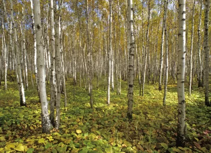
The views will be amazing in their own way no matter what time of year it is. In the fall, you can see tree colors challenge, and the undergrowth can look spectacular as well. In the winter, you’ll see trees with no leaves, but that extends the vistas at various points overlooking Lake Superior. In the spring, you’ll see the beginnings of leaves popping up. In the summer, you’ll see the full greenery on display.
This decision largely depends on whether you are day hiking or camping, and your tolerance for heat, cold, or bugs. Spring on the SHT can be muddy as well.
For those reasons, many hikers prefer late August and early September, as that’s when the bugs are at a minimum, but the temperatures are more comfortable with less humidity. Note that late September can see some chilly nights into the upper 30s or lower 40s, so be weather aware if you’re hiking in the fall.
What gear do I need to bring for day hikes?
Plan to bring any snacks or water you’ll need, a good pair of hiking boots or shoes, and possibly hiking poles.
What do I need for camping?
Plan to bring full backpacking gear, including a pack, a tent or hammock, and sleeping gear, plus what you’ll need to make food, filter water, and stay warm and dry during a day of hiking and a night of sleeping.

What are the most popular Superior Hiking Trail sections?
Every section of the SHT has beautiful views and is worth seeing at some point.
Here are some highlights….
Duluth
Duluth is a great place to hike the SHT and has many of the same types of views as the more remote areas up north, but with the added benefit of being in the city and having bars and restaurants available after a hike.
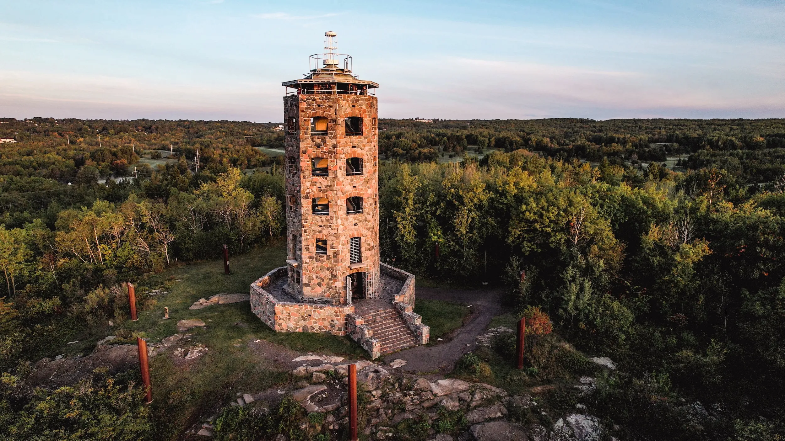
One spot worth hiking is near the Enger Tower, which has amazing skyline views of the city and horizon views over Lake Superior. While not on the SHT itself, there are four trails from the tower area to the official Superior Hiking Trail, which lies just to the north.
Two Harbors to Tettegouche State Park
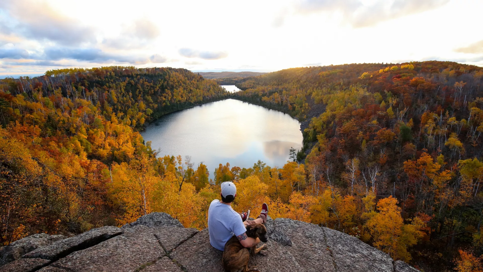
This area has some of the most amazing SHT sections, and it’s just a little farther north than Duluth. One highlight is the views just one mile into the trail at West Castle Danger Road Trailhead, as you head east/north. If you’re looking for a challenge, you can continue all the way to Gooseberry Falls State Park.
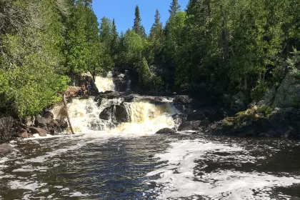
Another great section if you want the beauty of the SHT but not as many people is the Lax Lake Road Trailhead in Beaver Bay to Penn Boulevard Trailhead. This stretch has amazing river and waterfall views along the Beaver River (only about 1 mile in) and breathtaking views from some of the ridgelines near the end of the segment.
At just under 4 miles each way, that can make for a lengthy day hike. (Plan on about 4-5 hours.) A shorter option would be to turn around either after the Beaver River or after seeing the views from the first ridge.
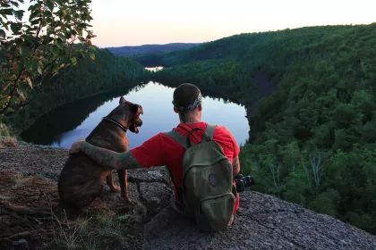
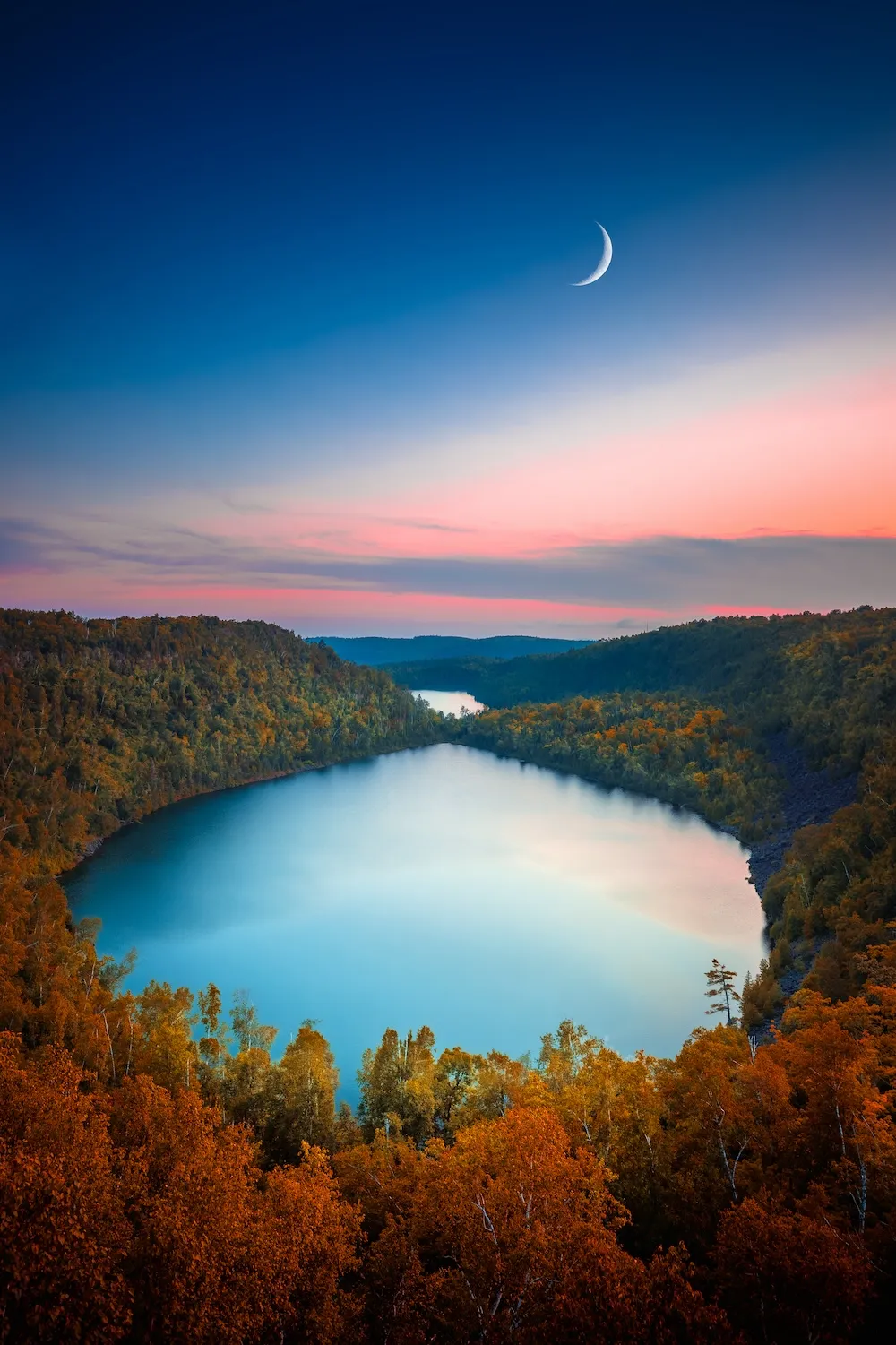
Just past Beaver Bay is Silver Bay, which has one of the most popular segments of trail on the entire SHT — the Bear and Bean Lake Loop. This roughly 6.5-mile loop is so popular that the Superior Hiking Trail Association closed it for the summer in 2024 to better protect it from people.
The views overlooking the lakes are impressive, and worth seeing if you’re new to the trail.
Tip: Visit the Penn Creek campsite as there’s a miniature gorge there when water is flowing that is a must see (usually spring or after a recent rain in summer or fall). The section continues through Tettegouche State Park and includes many ups and downs.
Highway 1 to Temperance River State Park
This segment has some gems worth checking out, especially if you enjoy a vigorous hike. One area of note is George H. Crosby Manitou State Park. At this state park there are campsites you can reserve, but they’re backpacking sites only. Many are along the river, and by reserving a spot you’ll have the campsite to yourself or your group.
Crosby Manitou contains quite a few steep ups and downs if traveling via the SHT, so keep that in mind if planning a trip. Many hikers average under 1 mile per hour in that stretch.
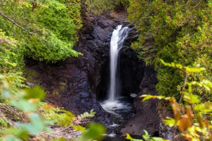
Continuing through the park toward the Caribou Falls State Wayside (or the reverse, which is a slow, but beautiful hike) you’ll see a little river gorge carved by the Caribou River, which is worth a stop for a snack or lunch.
Tip: There are some campsites along the Caribou River that tend to be popular but make for great scenery. Temperance River State Park has some well-maintained trails, and views of the “potholes” cut into the rock by the river. It’s worth a hike through if you’re in the area, and is beautiful if hiking via the SHT.
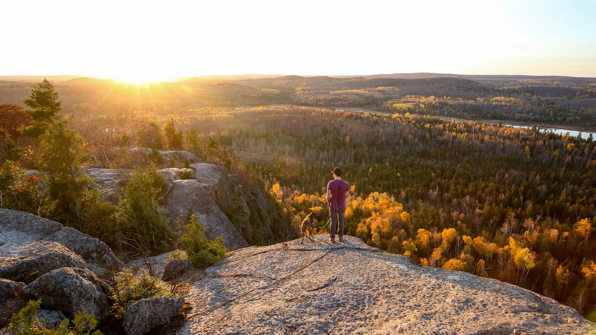
Temperance River Wayside Trailhead to Pincushion Mountain Trailhead
If you’re heading north toward Tofte, Lutsen and Grand Marais, there are quite a few segments worth exploring (most, really). This section has quite a few ups and downs, much like the one just south of the Temperance River.
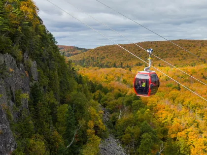
One tip is to explore the Lutsen area — either as a day hike or backpacking — and ride the chairlift down to the resort, then get lunch.
A popular destination is near Carlton Peak and Britton Peak, which you can access as a day hike or by backpacking. For the day hike version, you’d park at the Britton Peak Trailhead and hike about 1.5 miles southwest toward Carlton Peak’s overlook, making it about 3 miles roundtrip. For an add-on, you can continue to hike to Britton Peak, which is roughly a quarter mile from the parking lot.
Another hike worth looking into that’s also very popular is Oberg Mountain. There’s an Oberg Mountain Trailhead, and from there you’d hike to the Oberg Mountain Loop. The loop has plenty of scenic views and is just over 2 miles long, making it very accessible in terms of mileage and time needed.
Not too far north and east of Oberg is Cascade River State Park, with some of the best river hiking you’ll see on the entire trail on the SHT segment of that river, plus you can explore the state park if you’re traveling for the day.
Tip: Explore the Lutsen portion of the SHT, either as a day hike or backpacking, and ride the chair lift to the Summit Chalet, where you can get lunch with a view. It’s an extra special treat if you’re a backpacker and have been eating dehydrated meals for days.
Grand Marais to the Northern Terminus
This section ends just south of the Canada-United States border, and connects directly to the Border Route Trail, which is part of the North Country Trail.
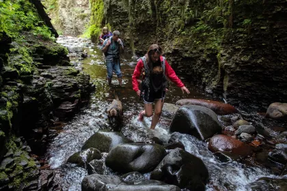
One key sites if you make it this far north is the Kadunce River gorge, accessible from the Kadunce River State Wayside Trailhead. Some adventure-seekers will hike in the river to explore this, which should only be done by experienced canyoneers.
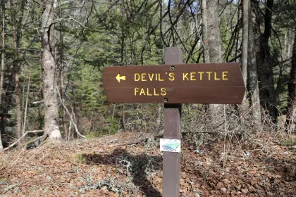
A bit farther north is the Judge C.R. Magney State Park Trailhead, which contains gorgeous waterfall views, such as the mysterious Devil’s Kettle and Upper Falls of the Brule River.
Finally, one thing worth seeing is the Lake Walk section of the SHT, which is the only section of the trail that is directly adjacent to Lake Superior. It’s known as a “pebble walk” as you’ll be walking on tiny wave-smoothed pebbles. While beautiful, they can be tough to walk on, so plan on a slow walk or minimize your distance. There is parking along the Lake Walk if you’re not looking to walk the entire nearly 1.5 miles of this stretch.